Missile Strike on Mykolaiv ODA
We collaborated with Truth Hounds to pinpoint the exact flight path of the Russian missile that hit the Mykolaiv Regional State Administration in March 2022. By placing this 3D reconstruction in a broader historical context, we illustrate the ongoing impact of conflict on local governance structures.
On March 29, 2022, Russia carried out an airstrike on the building of the Mykolaiv Regional State Administration. As a result, 37 people died, and 34 were injured. We supported the Ukrainian human rights group Truth Hounds in investigating this attack and also attempted to understand the intention behind it.
How much information can be extracted from one video?
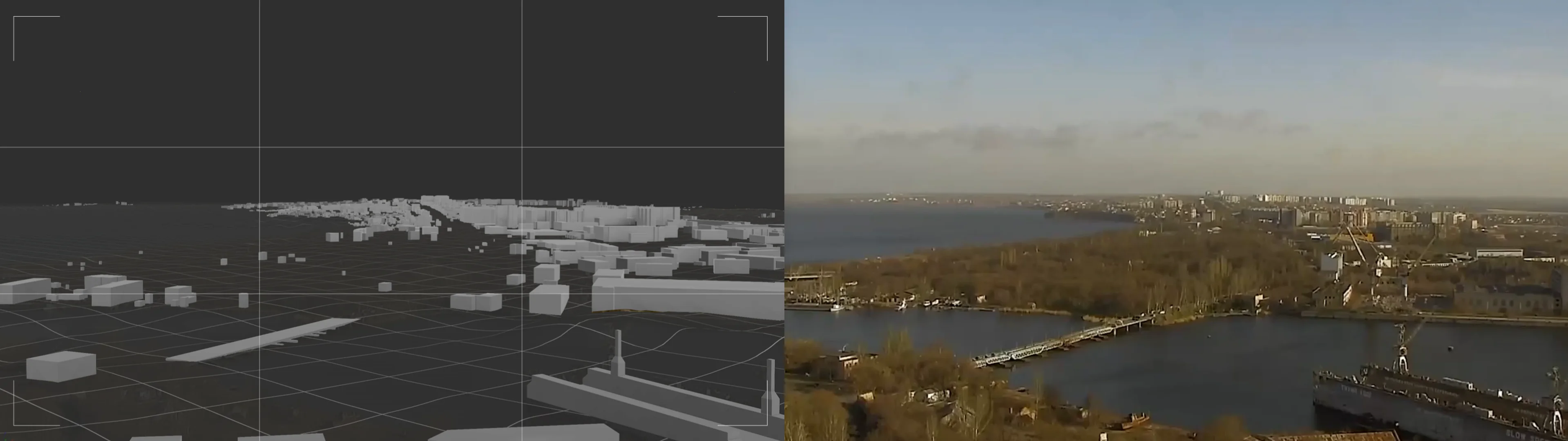
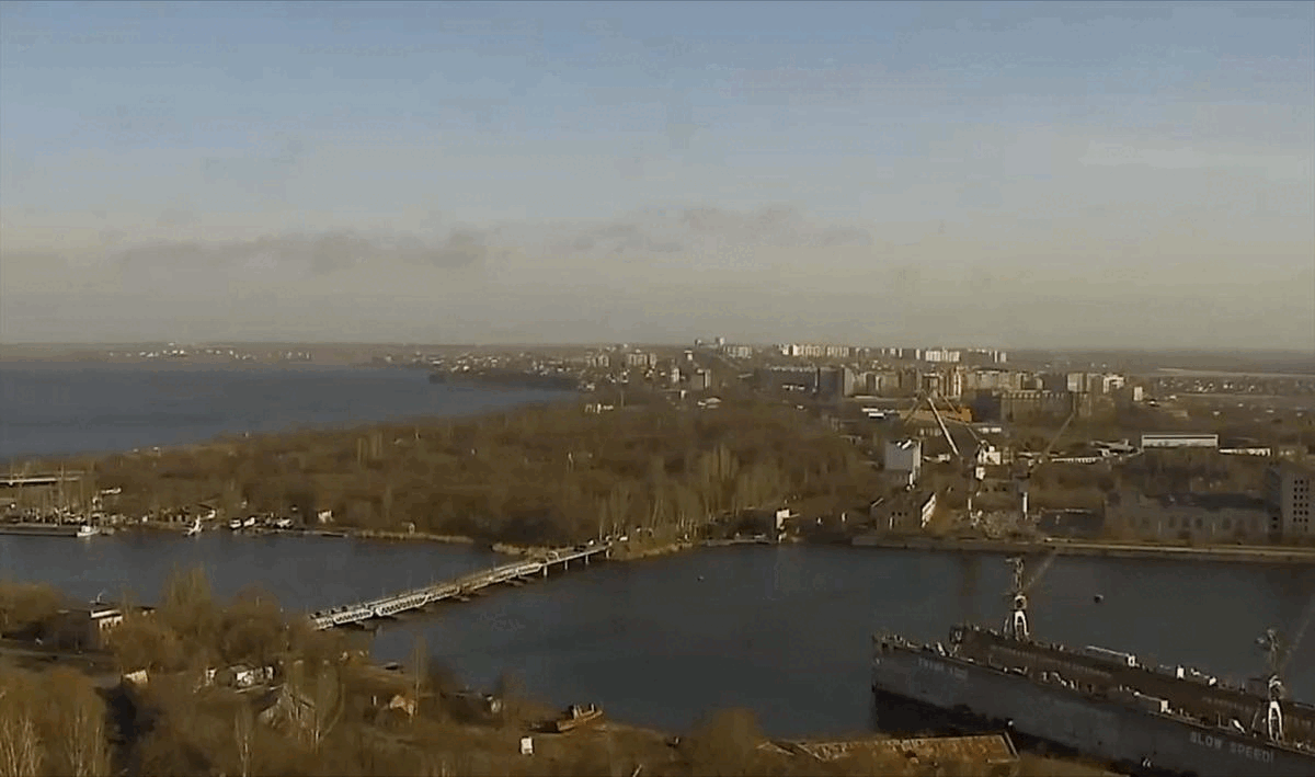
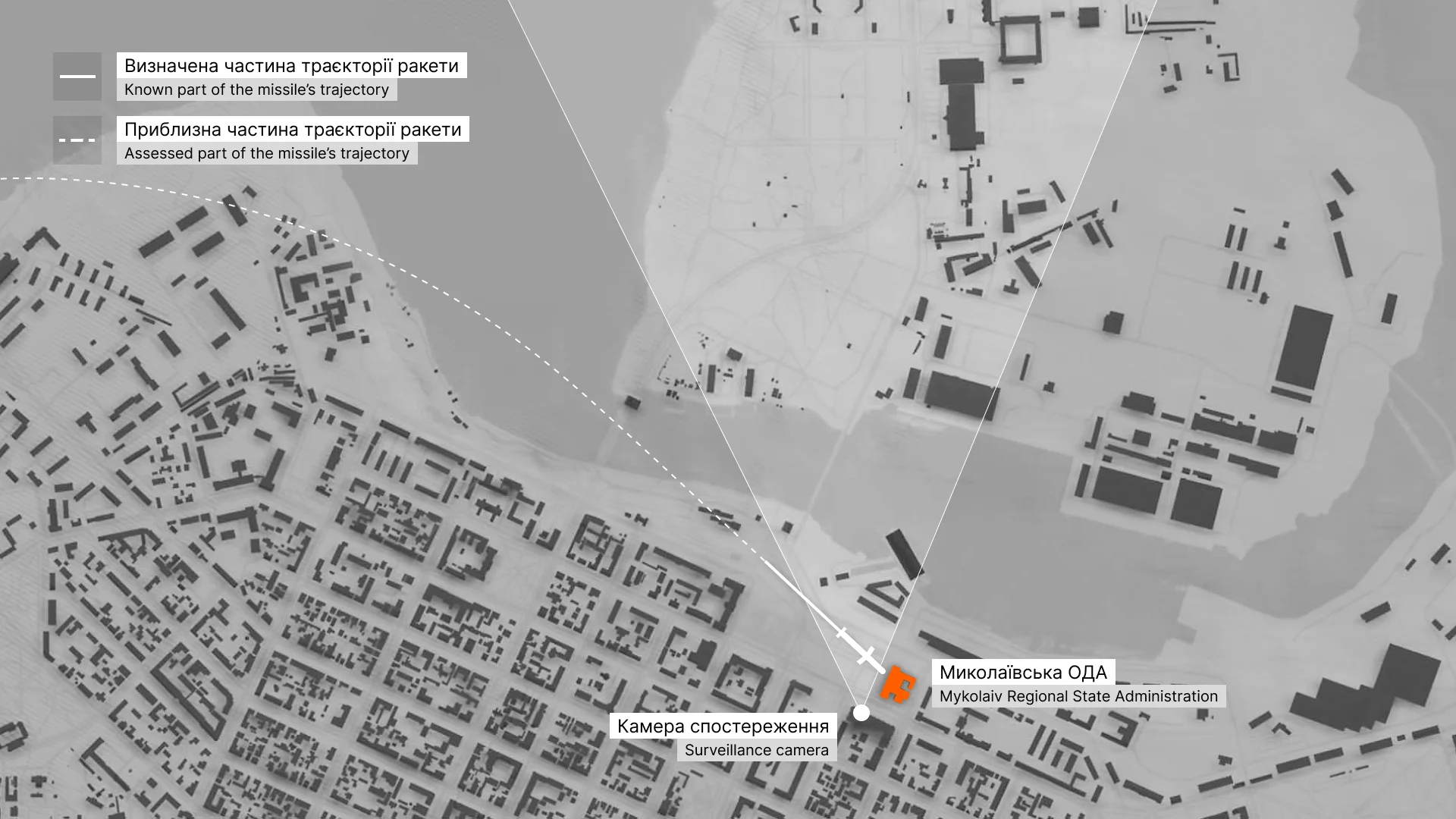
The video above is the only available footage capturing the missile that hit the Mykolaiv Regional State Administration building. It was recorded by a surveillance camera located on the roof of the “Admiral” housing complex across the street from the administration building. The camera view looks towards the northern districts of Mykolaiv.
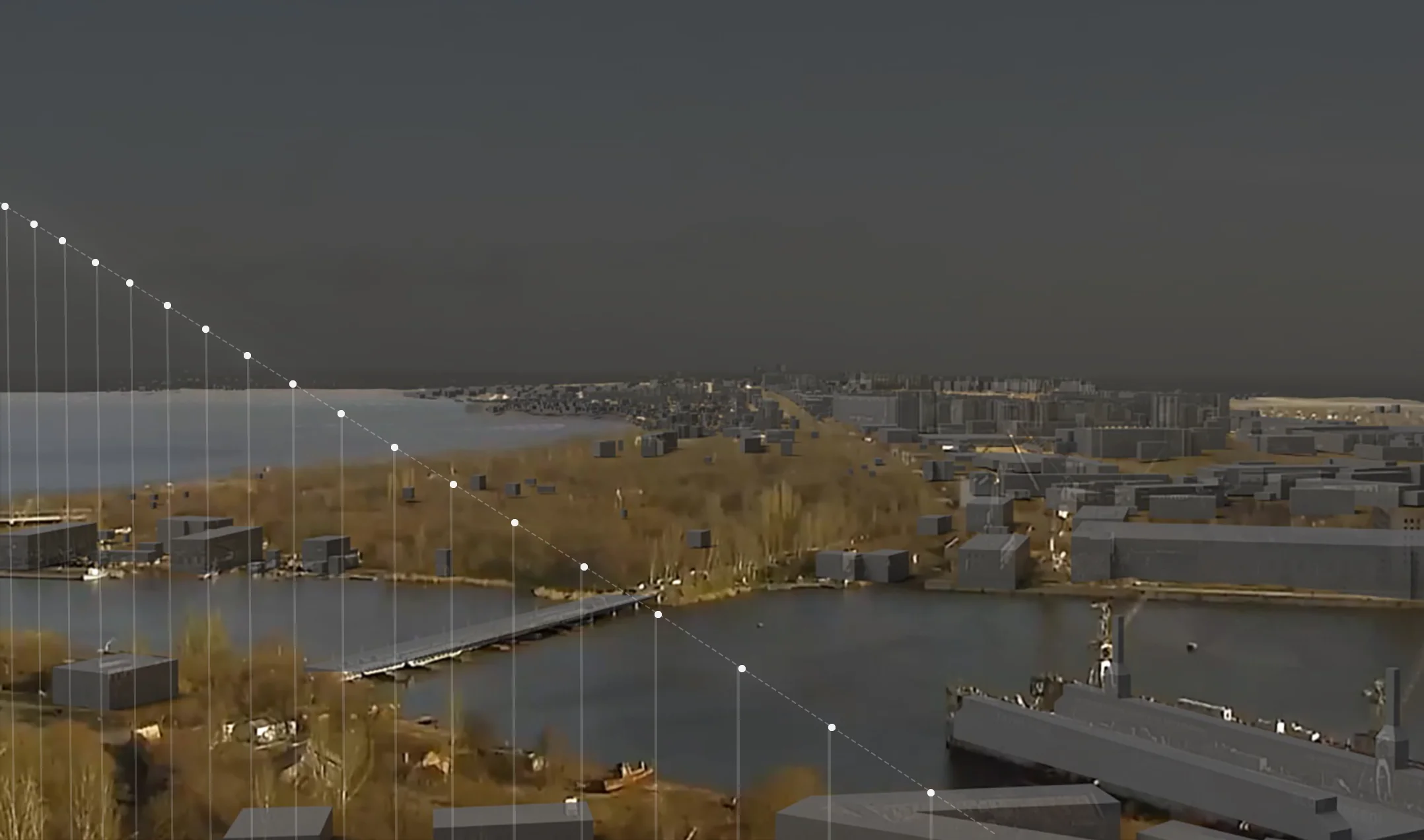
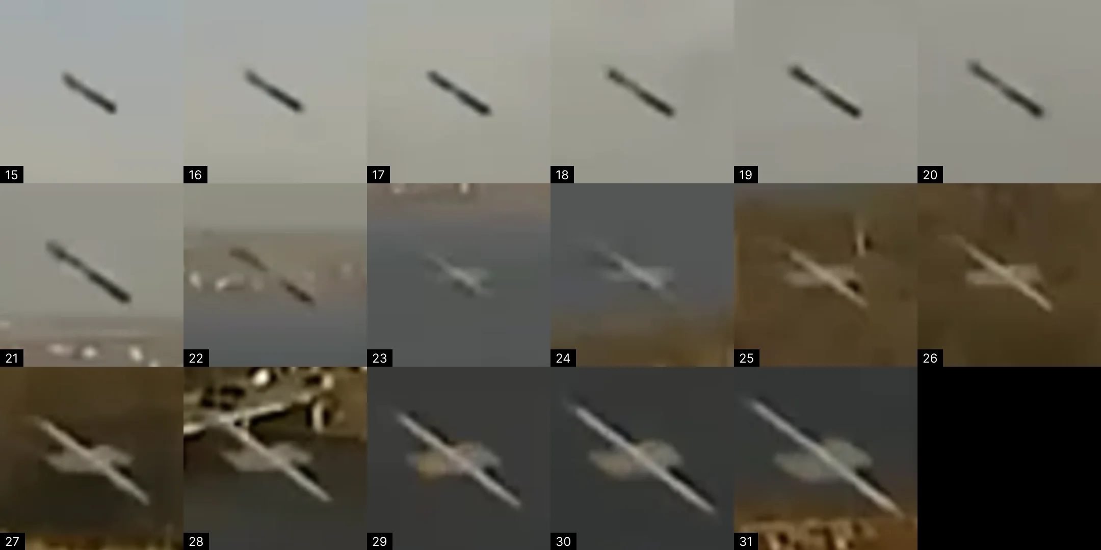
We placed a virtual camera within a 3d model of Mykolayiv to align its view with the surveillance camera. The Russian missile can be seen at the beginning of the video, between frames 14 and 32.
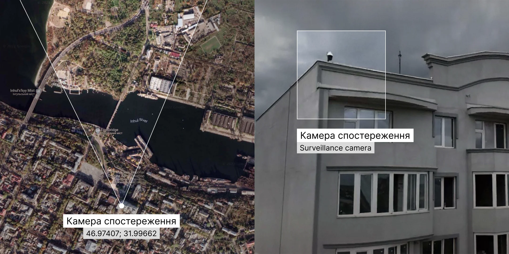
Knowing the camera's exact location and tracing the missile movement frame by frame, we established the exact trajectory angle in 3d space. This was done by drawing a plane perpendicular to the picture plane and finding a trajectory angle that would fit the perspective reduction on the video from the security camera.
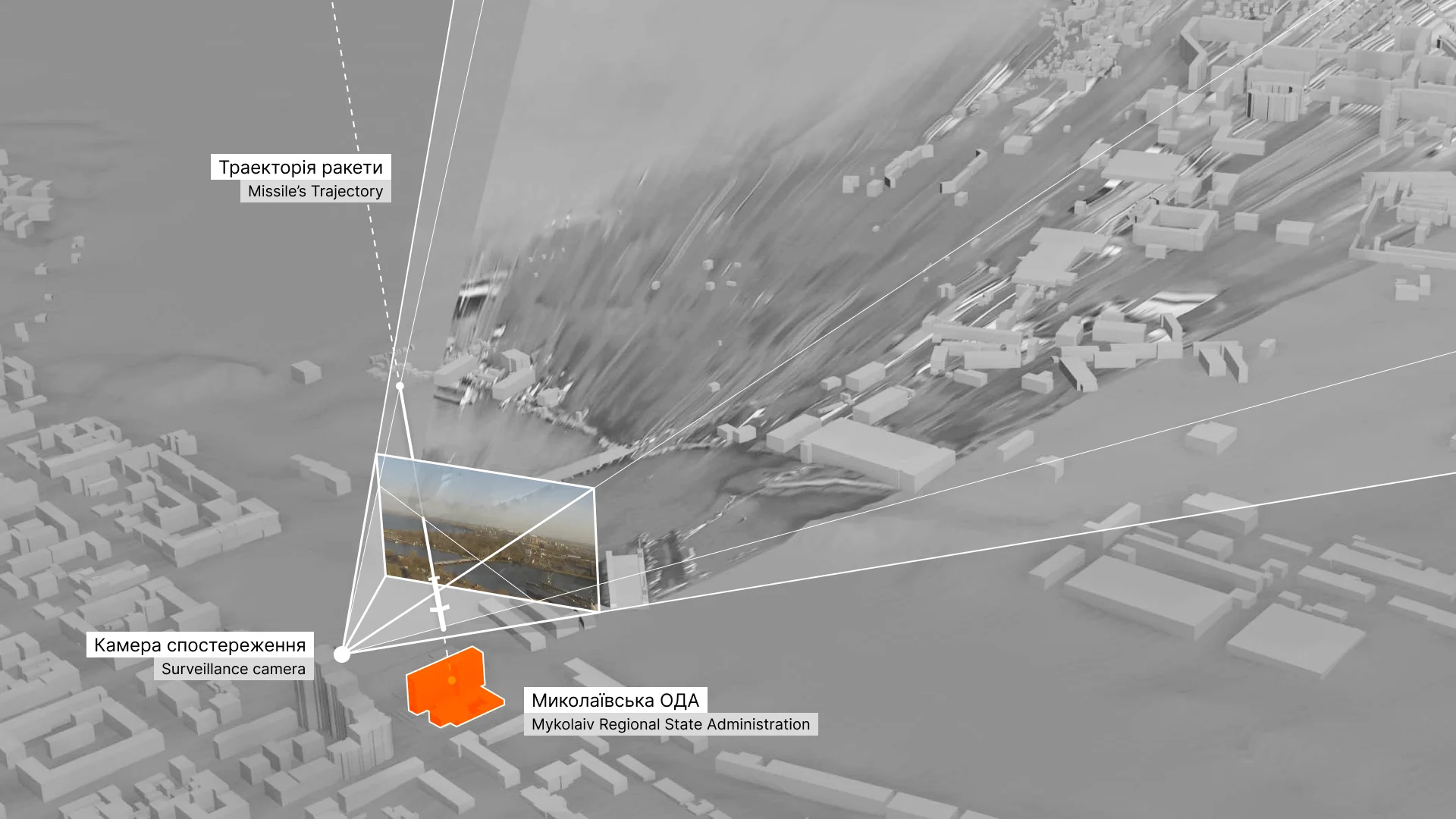
The Truth Hounds identified the missile as Kalibr 3M-14. This missile has a subsonic terminal speed of 0.8 Mach (approximately 275 m/s).
Using the 3d model of the environment with the established missile trajectory, we can now measure particular elements and/or quantities. For example, the distance between the missile’s nose cone on frame 14 and frame 31 is 170 meters. The video’s frame rate is 25 frames per second, which means that the missile passed the distance of 170 meters in 0.64 seconds, so its speed on this specific fragment of the trajectory was 266 m/s. This is close to the speed of the identified type of missile — 275 m/s (3.2% deviation).
Another way of identifying the missile’s type is to measure its length. Within the model, it is approximately 6.5 meters, while the spec length of Kalibr 3M-14 is 6.2 meters.
As a result of working with one video, we established the exact trajectory of the rocket in three-dimensional space and tested the hypothesis about the type of rocket by calculating its speed and size.
Photogrammetry
We verified the correctness of the found missile’s trajectory with the help of a photogrammetrical scan of the affected building. It helped us to analyze the destruction of the concrete structure and then made it possible to establish the epicenter of the explosion. Comparing it with the results of previous calculations confirmed our conclusions.
Photogrammetry of the consequences of the Russian attack on the Mykolaiv Regional State Administration was made based on the Truth Hounds shooting. (Center of Spatial Technologies)
Truth Hounds report
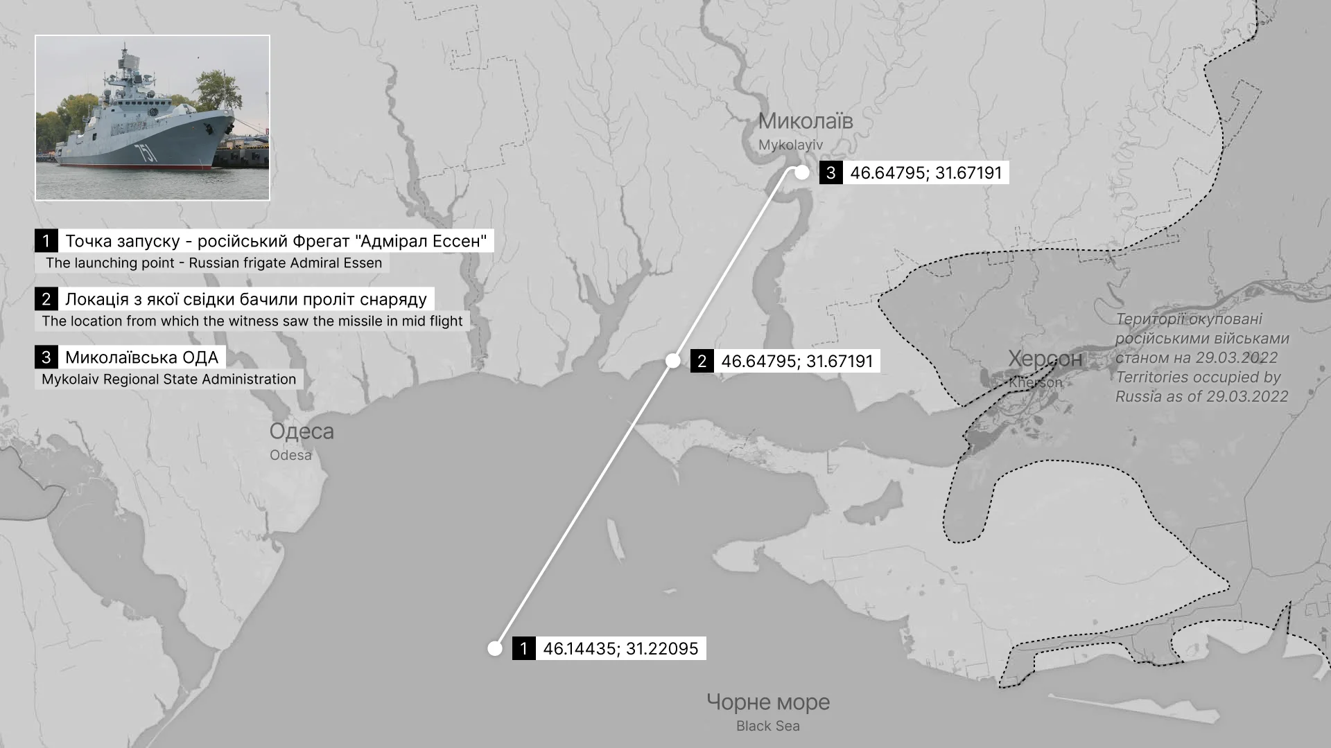
To learn where the Russian frigate Admiral Essen was located on March 29, 2022, as well as how we know that it was the exact 3M-14 missile launching point, and why this case can be qualified as a war crime — read the Truth Hounds report.
Why attack Mykolaiv Regional State Administration?
The Truth Hounds report stated that the building of Mykolaiv Regional State Administration was used entirely for civilian purposes. At the moment of the attack, several members of the Territorial defense and military representatives were in the building for protection purposes. Why, then, did the Russians attack the building?
Strategically important region
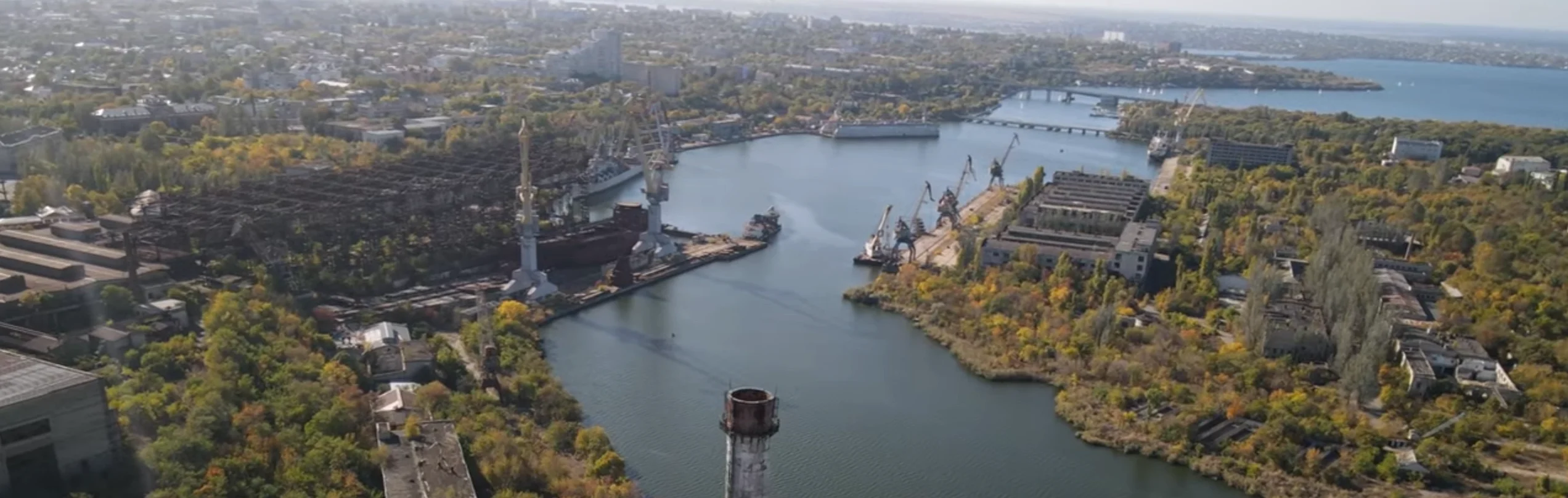
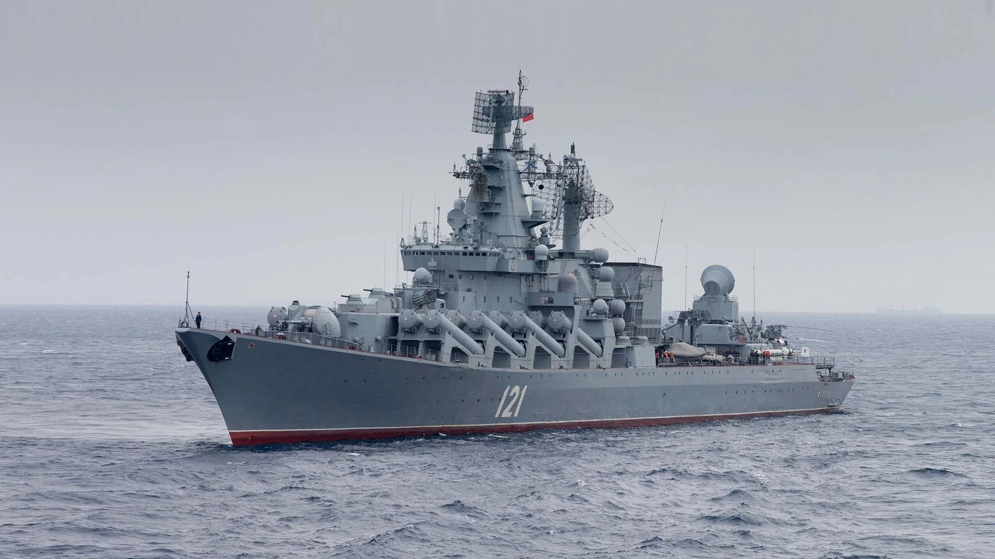
Mykolaiv is of paramount strategic importance: it is a crucial logistical hub (the city has Ukraine’s second-largest seaport, big river port, airport, and railway and highway hub) and Ukraine’s main shipbuilding center. Most of the Soviet Navy's surface ships (later inherited by the Russian Federation) were built in Mykolaiv, including its only aircraft carrier Kuznetsov, and the notorious battleship Moskva.
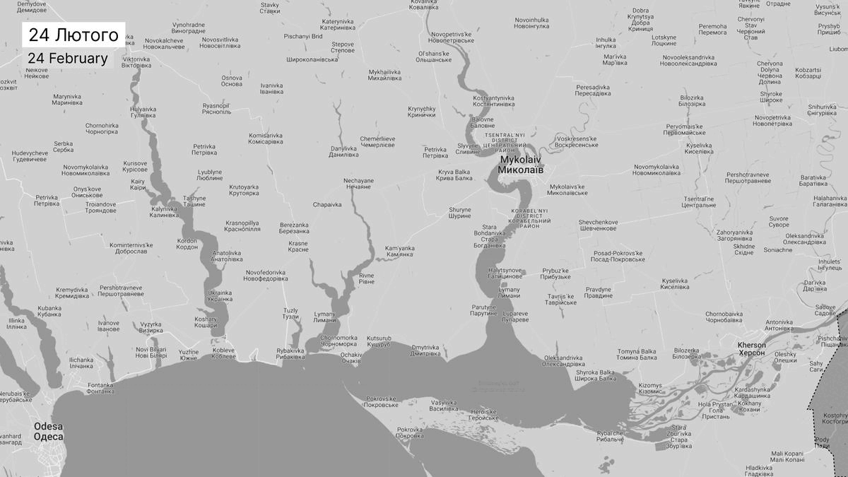
According to The New York Times and The Guardian, Mykolaiv was one of the main targets of Russia during the first phase of its 2022 invasion of Ukraine. Mykolaiv’s capture would open the way to Odesa, and its control would allow the creation of a land corridor to Transnistria. By 29 March, however, Russia lost the battle of Mykolaiv, having its forces pushed out of the border of the Mykolaiv region.
The center of governance
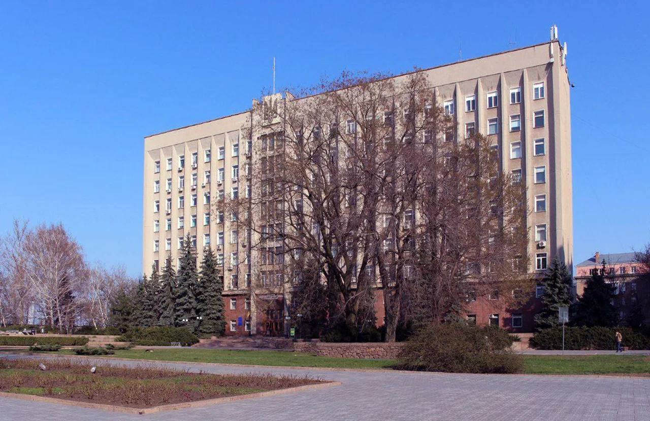
The Mykolaiv Regional State Administration building is the headquarters of local governance. The nine-story office building accommodated more than 100 government workers and the necessary equipment and communication networks.
Designed by the architect Petro Kazmirchuk and constructed in 1981, the building stands in the heart of the city, framing a sequence of public spaces. The simple and recognizable modernist facade with the Ukrainian flag and trident (Ukrainian coat of arms) is directly associated with the state apparatus.
Vitalii Kim
With the beginning of the full-scale invasion, Vitalii Kim, the head of Mykolaiv Regional State Administration and the Governor of Mykolaiv Oblast, became one of the most popular politicians in the Ukrainian Internet space, being associated with sincere openness and popular resistance. This makes him a significant target for the occupiers. On the day of the strike, Kim overslept and was late, saving his life. His secretary died because of the explosion.
![[collections/works/mykolaiv-oda/assets/images/vitalii-kim.png|Vitalii Kim, the Governor of Mykolaiv Oblast, in his office during the first days of the Russian invasion of Ukraine. (Vitalii Kim / Mykolaiv Regional State Administration)]]
Intention to weaken
One of Russia's goals in the war against Ukraine is its weakening. When the conquest of the new territories is impossible, it is necessary to weaken the opponent to reduce its development, resistance, and intensity of identity manifestation. It seems that the attack on the Mykolaiv Regional State Administration is based on precisely this logic because no valid military justifications for the attack have been found. Instead, it is obvious that the destruction of the local governance center and the assassination of the charismatic politician pursued the goal of weakening the strategically important region by violating the resistance processes and demoralizing the population.
Destruction of administrative buildings, cultural heritage, natural landscapes, infrastructure, industry, and, most importantly, human capital are proven mechanisms of imperial control. Ukrainian society is well aware of the nature of these mechanisms because it has had to deal with them systematically. You don't have to go far to remember this nature - the history of the place where the Regional State Administration building stands is full of examples of Moscow's imperial crimes.
History of the place
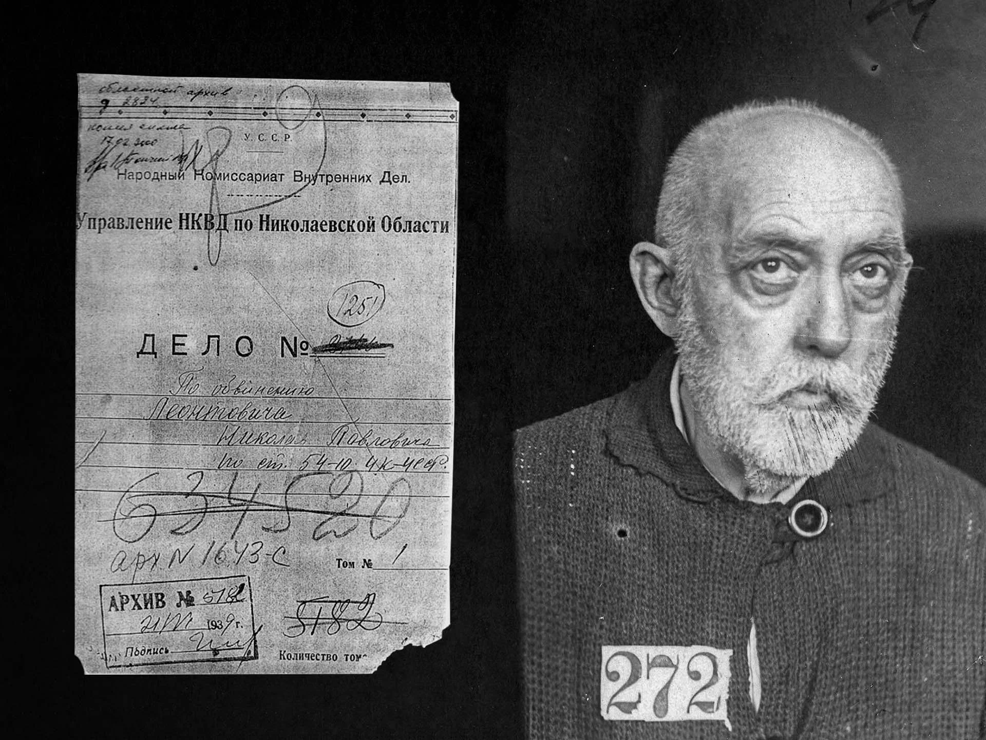
The Mykolaiv Regional State Administration building and the surrounding public spaces are located on the site and have a rich historical background. Previously, the private indoor zoo founded by eccentric mayor Mykola Pavlovych Leontovych was located here. He collected a unique collection of aquariums by European standards equipped with electric compressors and heaters. In 1901, the building that accommodated three thousand liters of aquariums opened its doors to visitors.
In 1903, Mykola Pavlovych became a member of the City Duma, in 1906 - deputy mayor, and in 1908 - mayor of the city. In 1917, he was arrested for the first time by the order of workers' deputies; in 1937 - Leontovych was arrested for the second time on a number of trumped-up charges. He died in prison. When asked by the investigator why he did not flee abroad after the Bolshevik revolution, Leontovych answered that he could not leave the aquarium in which he had invested his whole life.
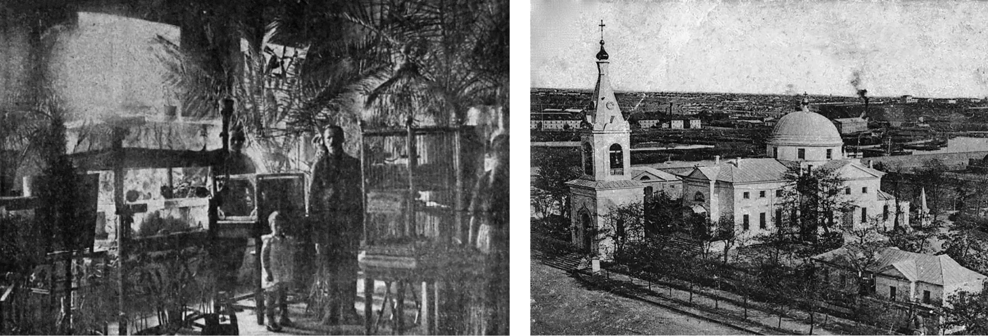
In 1923, the church was reformatted into the Ukrainian Cathedral. Later in 1929, the government decided to close it due to the ideological agenda of the Bolshevik authorities. However, the State Commission noted that the building was in good condition and was a great example of the "rare construction method of the end of the 18th century." Therefore, they decided to turn it into a museum building as a part of the Mykolaiv Historical and Archaeological Museum. All of the precious elements - bells, images, icons, etc were removed. The director of the museum, Feodosiy Kaminsky, tried to prevent the looting of church valuables, but this did not bring any results, except for the irritation of the Soviet leaders. The museum received the completely empty space of the former Cathedral; even the church bells were scrapped.
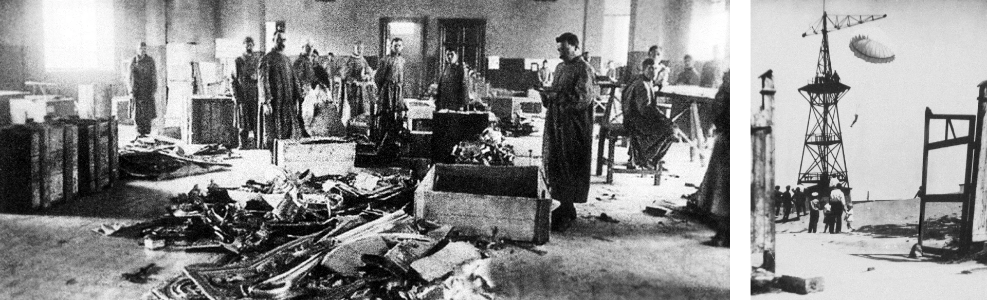
At the place where the church was located, a tower for parachute jumps was then built. Such activity was quite popular among young people at that time. In 1941, it was destroyed by the German invaders.
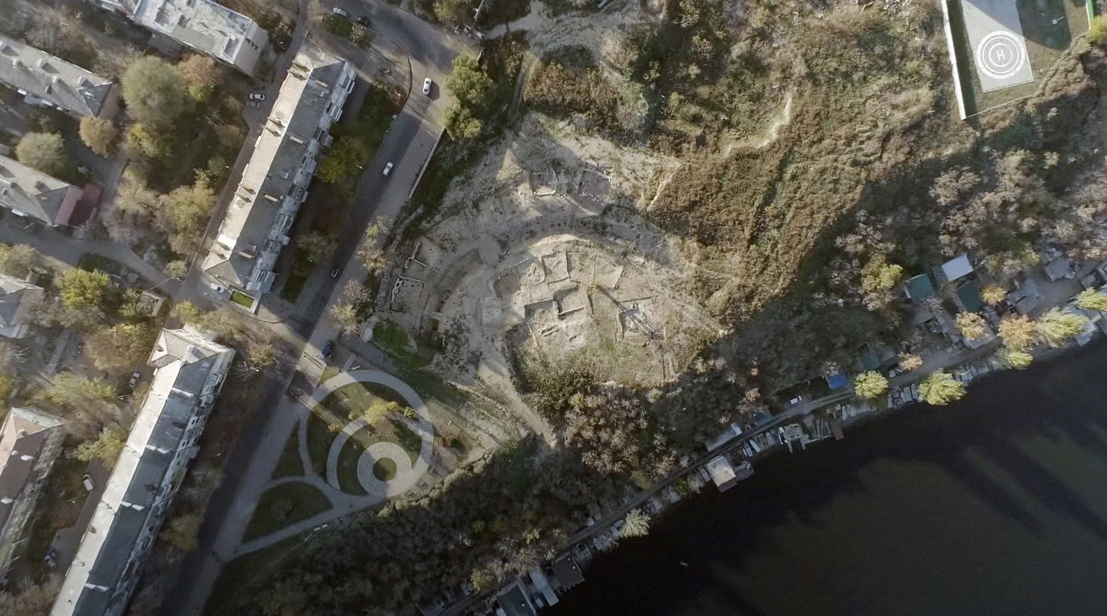
In 1927, one kilometer west of the building of the Mykolaiv Regional State Administration, in the very center of Mykolaiv, the Ukrainian archaeologist Feodosiy Kaminsky discovered an ancient port settlement — the city of the Cimmerian people. It is the oldest (1250-925 BC) mentioned in written sources settlement on the territory of Ukraine. In its heyday, the city combined the trade relations of the Cimmerians with the Greeks and Assyrians.
Kaminsky's archaeological find was ignored until the collapse of the Soviet Union. Then the excavations resumed after the disbandment of the military unit, which was based on the archaeological site.
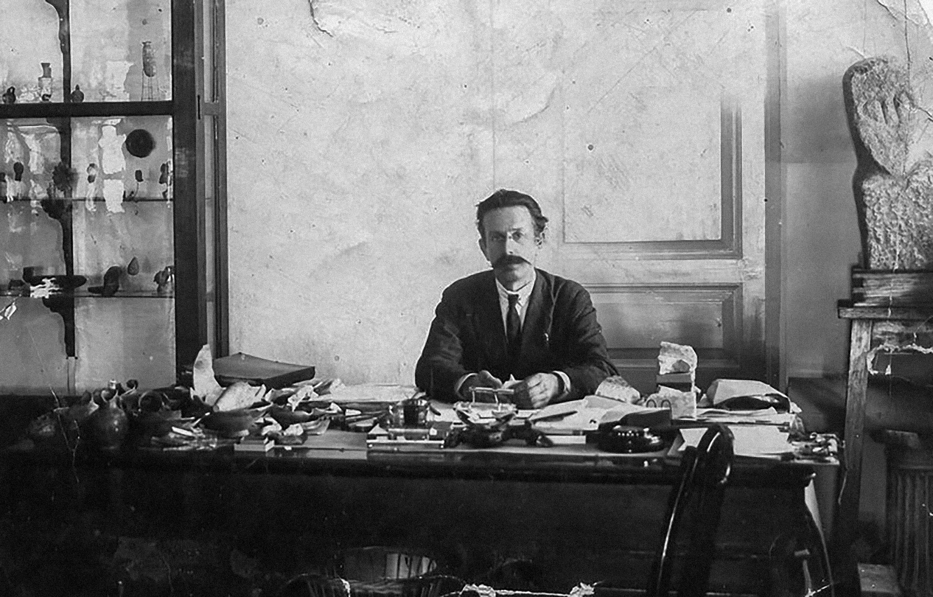
For his research and activism, Kaminsky was repressed by the Soviet authorities. In 1937, Feodosiy Timofiyovych was convicted for the third time. Overall, he spent 17 years in prison.
In 1937, when Mykola Leontovych and Feodosiy Kaminsky were once again imprisoned, and the city's Cathedral was blown up with dynamite, Ukrainian society was experiencing the peak of the Great Terror - the systematic Soviet repressions. It aimed to weaken, even suppress, the process of national revival, which threatened Sovietization, by destroying activists and centers of Ukrainian identity.
The Mykolaiv Regional State Administration is located in the historical city block.
The historical city block used to be occupied by the complex of the Orthodox Church of St. Gregory the Great of Armenia; now, the park is located there.
The site is where the remains of the ancient Cimmerian settlement were excavated in 1927.
Mykolaiv Shipyard. (Center for Spatial Technologies)