The Center for Spatial Technologies (CST) is a Ukrainian multidisciplinary research organization.
Blending architecture, computer science and the humanities, we investigate cities' past, present, and future.
instagram
twitter
[email protected]
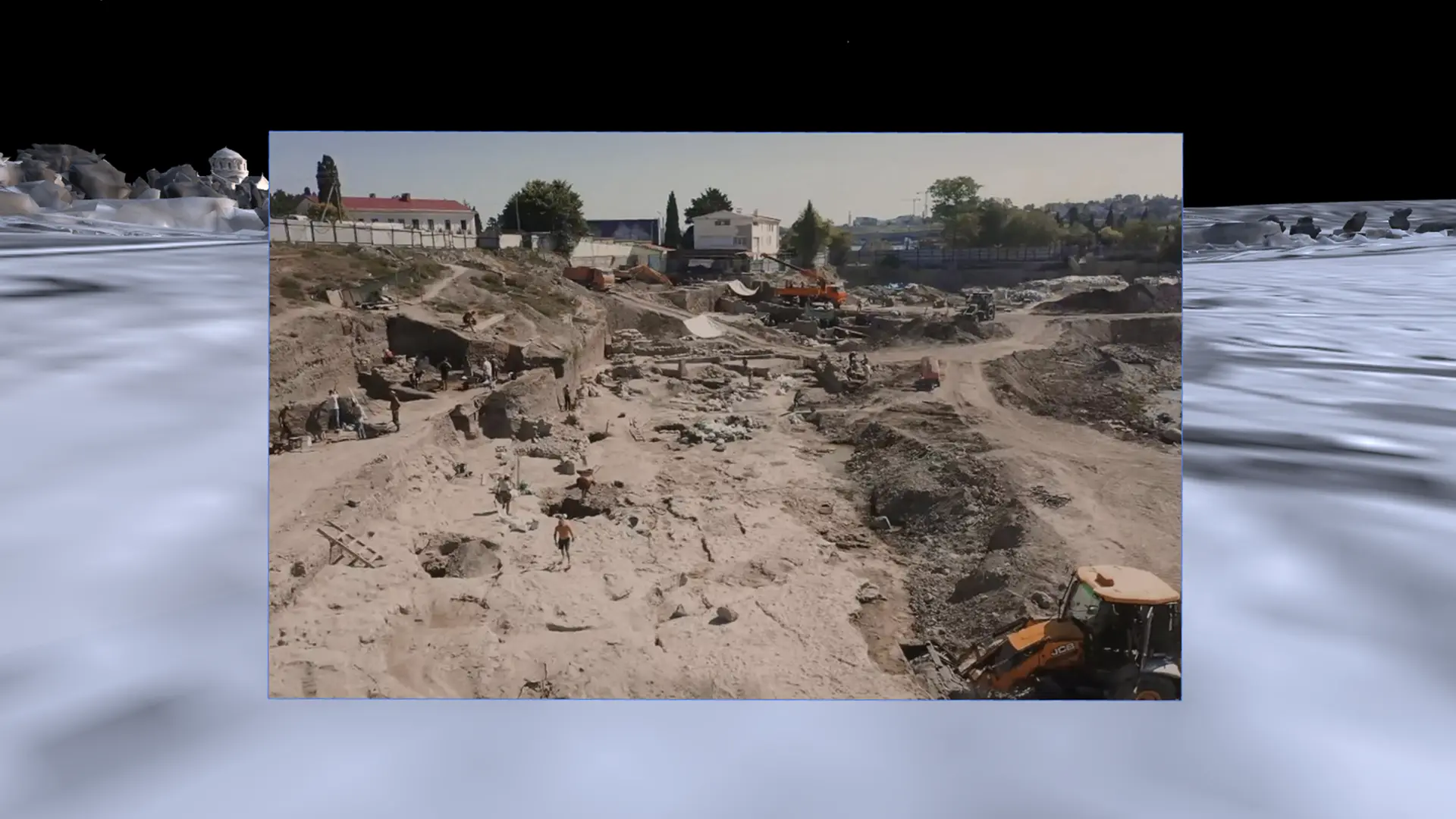
Church, Chora, Chersonese
Installation, media, archaeology, cultural heritage
Two-screen video installation showing how archaeology at Chersonese has been conscripted for political ends from the late 1700s to Russia’s present occupation of Crimea.
Mariupol Drama Theater
Spatial reconstruction, history and culture
This study reconstructs the Mariupol Drama Theater, exploring how it became a symbol of civilian resistance and solidarity amidst devastating war, and, at the same time, of Russia's strategies of terror. By gathering photographs, videos, spatial models, and eyewitness accounts, we aim to preserve the theater's cultural legacy and contextualize this historic event.
Nebelivka Hypothesis
archaeology, history, and cities
This project studies one of the earliest and largest known settlements in Europe, presenting a new perspective on the origins of cities and the nature of urban life. Developed in collaboration with Forensic Architecture and archaeologist David Wengrow for the 18th International Architecture Exhibition of the Venice Biennale, it challenges existing narratives about how complex urban centers first emerged.
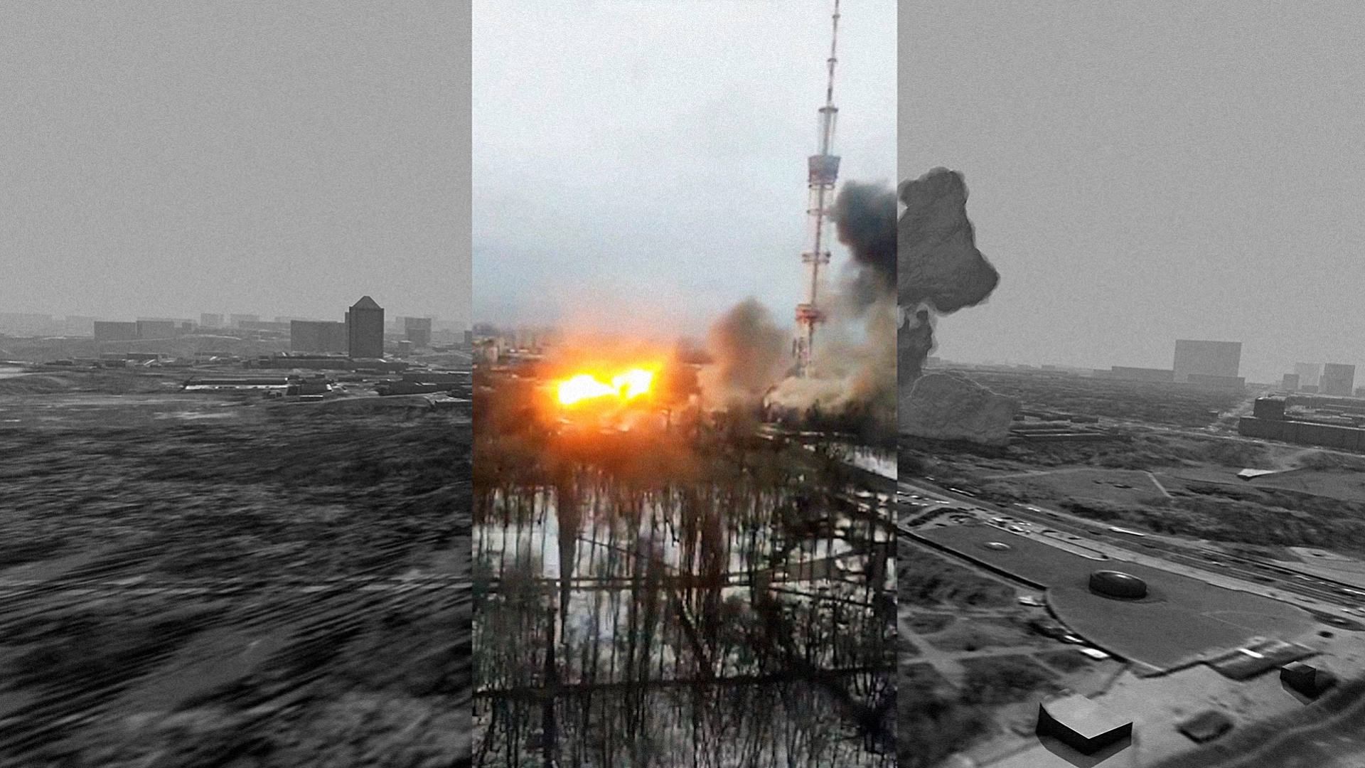
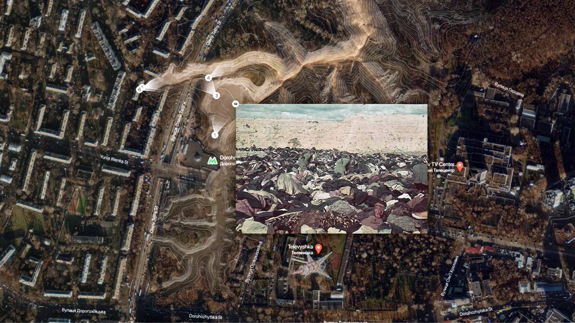
Russian Attack on Kyiv TV Tower
Digital project of reconstruction
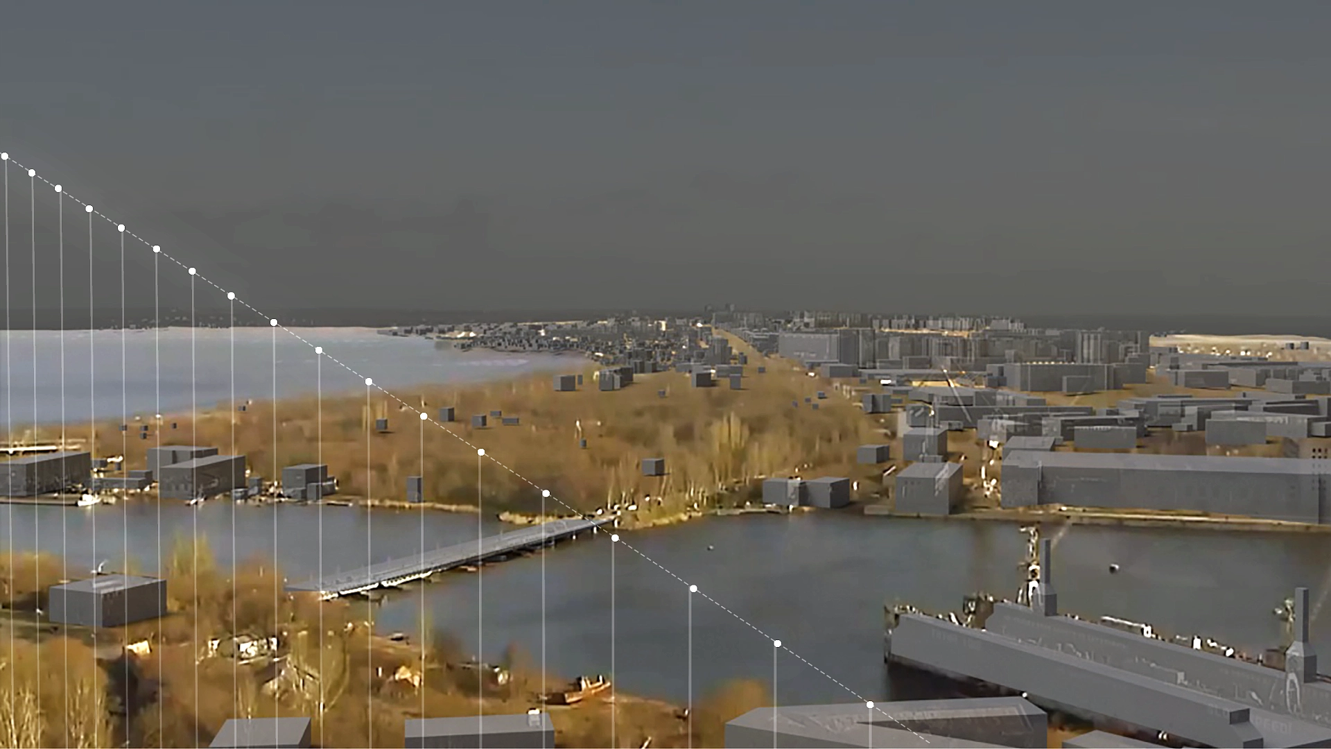
We analyze the Russian missile strikes on the Kyiv TV Tower in three dimensions, placing them in direct relation to the adjacent site of Babyn Yar. By mapping historical and modern attacks side by side, this investigation highlights the continuity and impact of conflict in this area.
Babyn Yar Spatial Reconstruction
Spatial reconstruction, history and geography
This spatial investigation traces the history of Babyn Yar—site of major WWII atrocities—across different periods. Incorporating archival maps, photographs, video testimonies, and historical records, the project reveals how transformations in the landscape reflect some of the most tragic events of the 20th century.
Matr
Software for environmental data
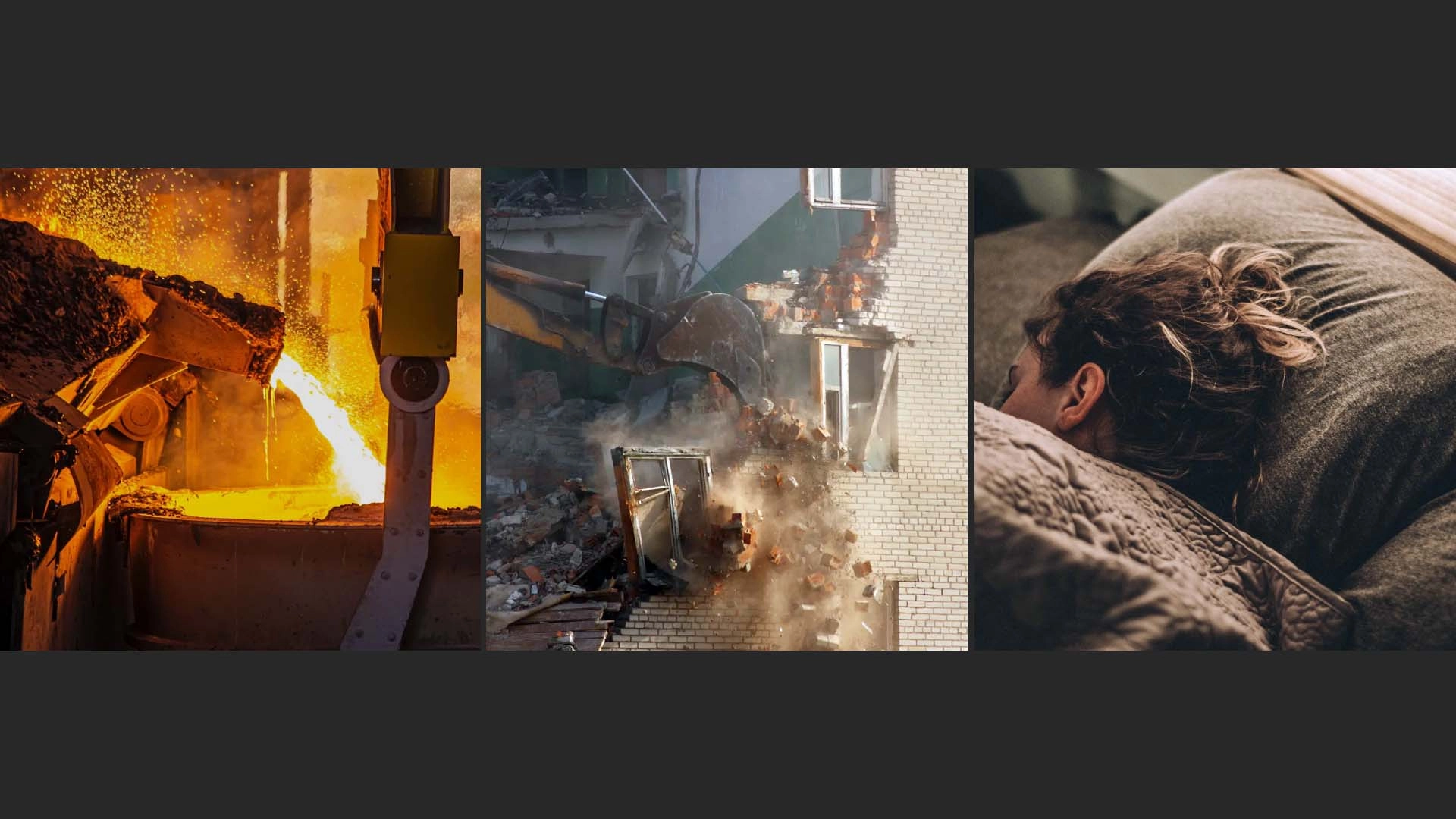
MatR is a prototype tool for working with data about materials, building performance characteristics and their environmental impact. The project emphasizes the need for a holistic approach to building assessment, promoting sustainable building practices, combating the climate crisis and reducing the impact of excessive construction and material production on environmental pollution.
Missile Strike on Mykolaiv ODA
We collaborated with Truth Hounds to pinpoint the exact flight path of the Russian missile that hit the Mykolaiv Regional State Administration in March 2022. By placing this 3D reconstruction in a broader historical context, we illustrate the ongoing impact of conflict on local governance structures.
Networked Homes
Digital research project
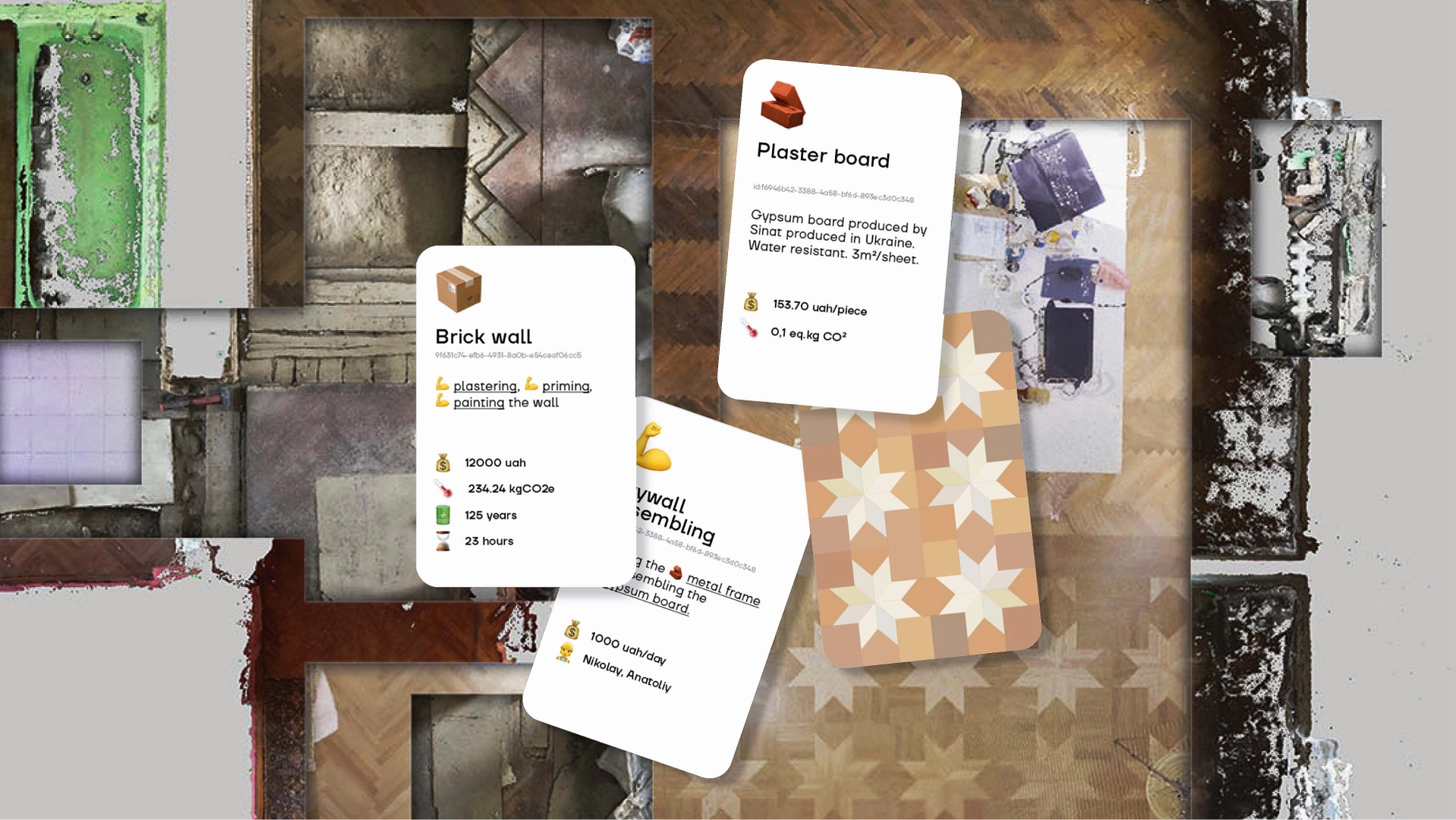
This project explores how building materials and elements within domestic spaces interact with each other and their surroundings. Through a detailed digital model of a simple apartment renovation, we show how each component "converses" with others—from sourcing and production to final use. By tracing these material networks, the study highlights the broader social and environmental implications of our design choices.
Domestic Datascapes
Video installation, Property tech
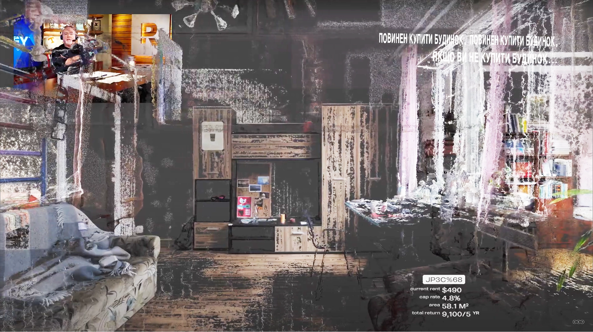
This video installation examines the transformative effects of "PropTech" platforms on domestic life. While real estate has traditionally been a conservative industry, recent technological disruptions—from algorithmic valuation to new debt‐financing mechanisms—are reshaping how we experience and understand our homes. By exploring the financialization of housing, the project reveals how spaces once rooted in social or personal utility are increasingly commodified.
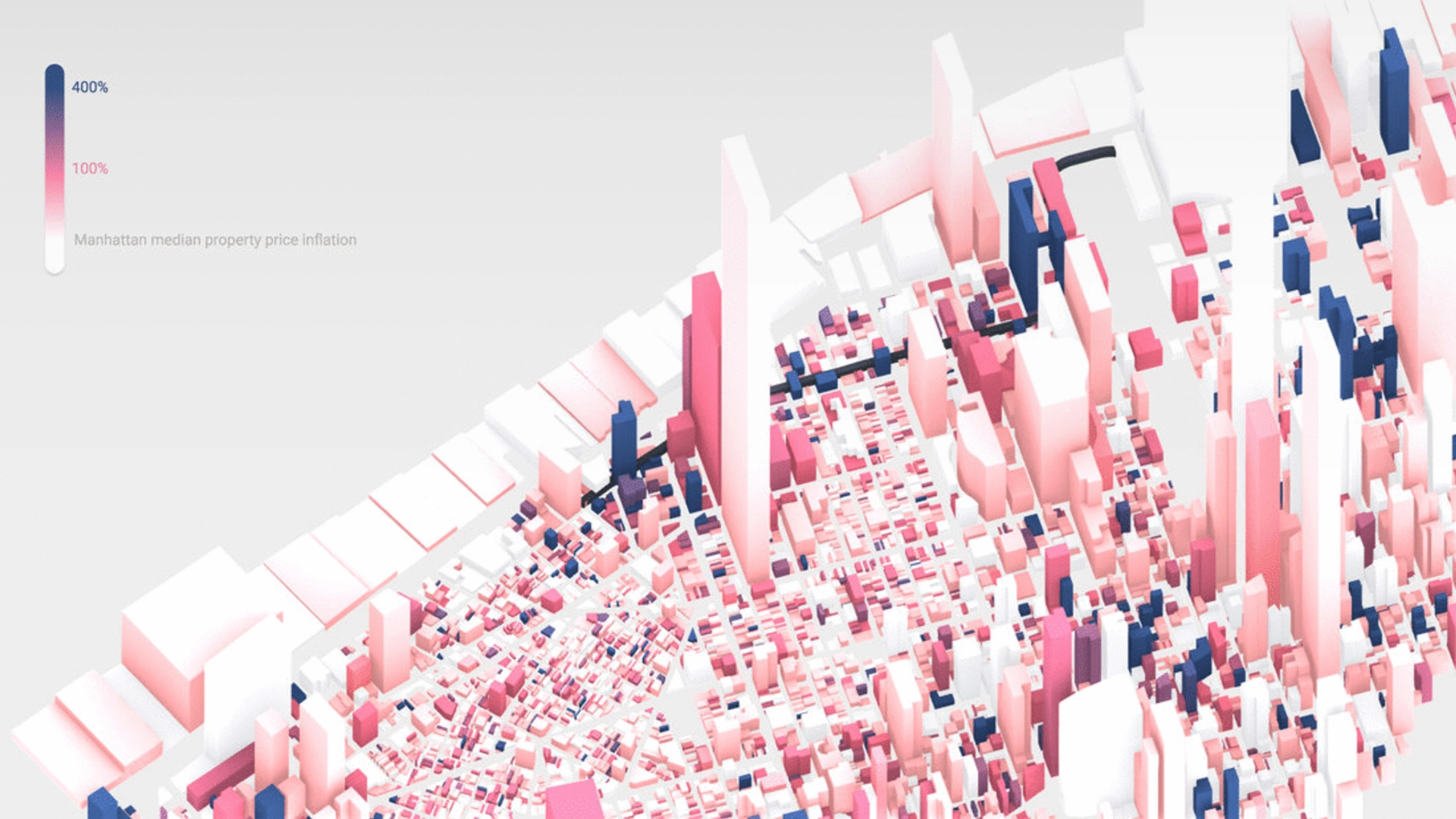
Smart Commons
Data visualization, Cities
Public infrastructure often generates significant private profit via land value uplift, yet mechanisms to redistribute this wealth remain inadequate. The “High Line Effect” investigates this dynamic using public tax registry data to analyze how Manhattan’s High Line—a publicly funded park—transformed nearby property values. Despite costing $187 million to build, it contributed to a $3.4 billion increase in adjacent property values, of which only $103 million was recouped in additional taxes. This project underscores the need for innovative policy frameworks to ensure public investments result in equitable urban development.